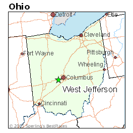
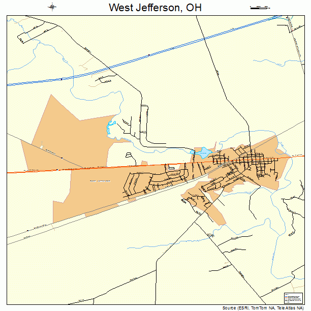
West Jefferson is a village in Madison County, Ohio, United States. The population was 4,137 at the 2020 census. Located along U.S. Route 40, the village has a fairly close relationship with the surrounding township, which include various out-of-corporation-limit neighborhoods (including Haymarket Road, Olmstead Road, Forrest Lake Estates, Goodson Road/Enchanted Valley, and North and South Road).
History
Overview
West Jefferson, founded by Samuel Jones and Samuel Sexton, was originally called New Hampton. The current name was platted c. 1831. A post office called West Jefferson has been in operation since 1833.
Early settlement
The majority of West Jefferson's early history is unknown. There are some records, but most major documentation does not occur until the late 1840s. During 1848-1849, the Columbus and Xenia railroad raised $20,000 from the citizens of Madison county to build a railroad. The original railroad station build within West Jefferson appears to no longer exist, however, a slightly newer railroad station (most likely built before 1938) still exists as part of the Fisher Cast Steel Mill. Unlike the trains that used to run through the town in the 1930's, the current trains are diesel and transport freight instead of passengers.
Later, during 1893, the town hall was built, which replaced the previous town hall built in 1855. The 1893 hall was the 3rd building to stand there. The first building on that plot is unknown. Originally, it was locally known as the "opera house", due to it housing a movie theatre until sometime in the 1930's or 40's. In 1958, the top few stories (most likely 3 or 4) were removed due to structural instability.
Oddly, on a cornerstone of the building, the message inscribed calls the town hall the city hall. It is unknown why that was inscribed.
2021 shooting
On May 24, 2021, a mass shooting occurred at an apartment complex in West Jefferson. Three men and one woman were killed, with three of the victims being found inside the building and one outside. A motive has not been determined for the shooting. On June 14, a 35-year-old suspect was arrested and charged with the killings. The shooting marked West Jefferson's first homicides since April 2012. In February 2024, the shooter, John Steckel, was convicted of four counts of aggravated murder for the shooting and was sentenced to life without parole.
Geography
According to the United States Census Bureau, the village has a total area of 4.87 square miles (12.61 km2), of which 4.85 square miles (12.56 km2) is land and 0.02 square miles (0.05 km2) is water. Within Jefferson Township (the township in which West Jefferson inhabits), there are two major creeks which run through it: Little Darby creek, a tributary of Big Darby Creek, and later the Scioto River and Big Darby Creek itself, which runs along part of the eastern border with Franklin county.
Demographics
2010 census
As of the census of 2010, there were 4,222 people, 1,617 households, and 1,149 families residing in the village. The population density was 870.5 inhabitants per square mile (336.1/km2). There were 1,709 housing units at an average density of 352.4 per square mile (136.1/km2). The racial makeup of the village was 97.6% White, 0.5% African American, 0.3% Asian, 0.2% from other races, and 1.4% from two or more races. Hispanic or Latino of any race were 0.9% of the population.
There were 1,617 households, of which 35.4% had children under the age of 18 living with them, 51.3% were married couples living together, 13.7% had a female householder with no husband present, 6.1% had a male householder with no wife present, and 28.9% were non-families. 25.7% of all households were made up of individuals, and 11.4% had someone living alone who was 65 years of age or older. The average household size was 2.55 and the average family size was 3.02.
The median age in the village was 38.5 years. 25.5% of residents were under the age of 18; 7.9% were between the ages of 18 and 24; 25.4% were from 25 to 44; 25.6% were from 45 to 64; and 15.6% were 65 years of age or older. The gender makeup of the village was 48.9% male and 51.1% female.
2000 census
As of the census of 2000, there were 4,331 people, 1,631 households, and 1,180 families residing in the village. The population density was 1,306.0 inhabitants per square mile (504.2/km2). There were 1,704 housing units at an average density of 513.8 per square mile (198.4/km2). The racial makeup of the village was 99.01% White, 0.02% African American, 0.16% Native American, 0.14% Asian, 0.02% Pacific Islander, 0.09% from other races, and 0.55% from two or more races. Hispanic or Latino of any race were 0.58% of the population.
There were 1,631 households, out of which 36.7% had children under the age of 18 living with them, 56.5% were married couples living together, 11.1% had a female householder with no husband present, and 27.6% were non-families. 22.6% of all households were made up of individuals, and 9.6% had someone living alone who was 65 years of age or older. The average household size was 2.60 and the average family size was 3.07.
In the village, the population was spread out, with 27.4% under the age of 18, 7.9% from 18 to 24, 29.5% from 25 to 44, 21.9% from 45 to 64, and 13.4% who were 65 years of age or older. The median age was 35 years. For every 100 females there were 95.4 males. For every 100 females age 18 and over, there were 90.7 males.
The median income for a household in the village was $41,949, and the median income for a family was $50,046. Males had a median income of $36,073 versus $26,734 for females. The per capita income for the village was $20,425. About 6.1% of families and 5.9% of the population were below the poverty line, including 7.6% of those under age 18 and 6.5% of those age 65 or over.
Library
West Jefferson is served by the Hurt/Battelle Memorial Library. In 2005, the library loaned more than 81,000 items to its 9,500 cardholders. Total holdings are over 57,000 volumes with over 60 periodical subscriptions. The Library also has a large collection of VHS tapes.
References
External links
- Official website
- Hurt/Battelle Memorial Library